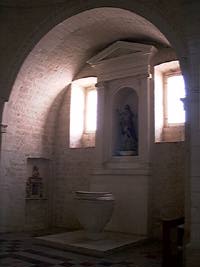
The most suitable software is currently QuickTime VR Authoring Studio which, thanks to the processing of photographic images obtained by rotating the camera around its own axis or around an object, allows the creation of dynamic and mappable digital images, with to which we can move within an urban center or a building, or we can rotate the image of an object around its own vertical or horizontal axis.
 Undoubtedly, again in the case of the Matrix church of Cisternno, we can use a mapped plan to view and connect the photographs, but we must recognize that, by greatly increasing the number of frames, we risk disorienting the visitor, rather than helping him to visit the monument.
A little progress can be made by recalling, with the same planimetry, 360 ° images, obtained with the software mentioned above and which are much more communicative than ordinary photographs. By clicking on the points marked in red, after waiting a few seconds, the plan is replaced by a photograph, on which the cursor changes shape. By holding down the mouse button, you can drag the image left or right, up or down, until the frame rotates 360 ° around a vertical axis. At the bottom of the photograph there is a bar with some buttons, two of which (marked with the "+" and "-" icons) are used to reduce or increase the viewing angle. Finally, by clicking on the Scene button of the plan, it is possible to recall the image of the facade, which, unlike the previous ones, is mapped and, always with the click, allows us to enter the cathedral, climb to the top of the tower facing the entrance, or turn into the side street. The sensitive areas are identified, in addition to the change in the shape of the cursor, by the button shown in the lower bar of the image and having an arrow and a question mark as an icon: by selecting this button, the sensitive areas are colored blue.